302 Coca from the air

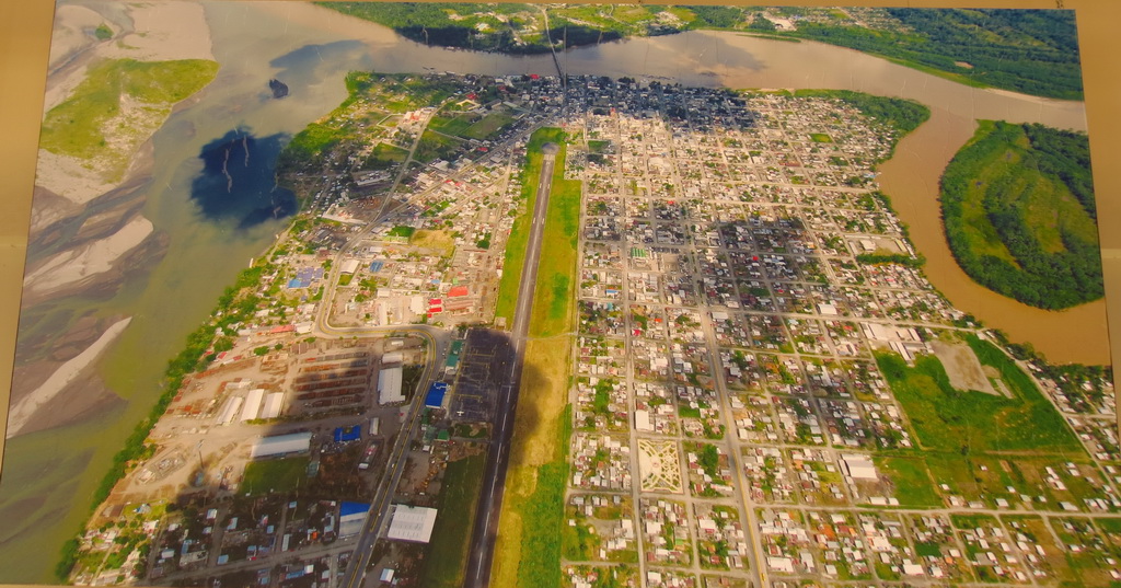
An aerial photograph of Coca, our town of construction. The river to the left is the Coca River that merges with the Napo River, flowing in the top of the images. We constructed the raft on the small Payamino river, which can be seen curving in the right of the image.

Leave a Reply

Fill in your details below or click an icon to log in:

WordPress.com Logo

You are commenting using your WordPress.com account. Log Out /  Change )

Facebook photo

You are commenting using your Facebook account. Log Out /  Change )

Connecting to %s

Create a free website or blog at WordPress.com.